


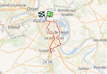
Pont de l'Ache - Louviers -St pierre du Vauvray

karani27
User

Length
38 km

Max alt
135 m

Uphill gradient
379 m
Km-Effort
43 km

Min alt
2 m

Downhill gradient
378 m
Boucle
Yes
Creation date :
2020-05-23 16:09:17.418
Updated on :
2020-06-14 16:33:03.098
2h55
Difficulty : Very difficult
--
Difficulty : Very easy
--
Difficulty : Very easy

FREE GPS app for hiking
 SityTrail
IGN / Geographical institutes
SityTrail Plus
The world is yours!
About
Trail Mountain bike of 38 km to be discovered at Normandy, Eure, Pont-de-l'Arche. This trail is proposed by karani27.
Description
Boucle au départ de Pont de l'Arche qui empreinte essentiellement les voies vertes
Positioning
Country:
France
Region :
Normandy
Department/Province :
Eure
Municipality :
Pont-de-l'Arche
Location:
Unknown
Start:(Dec)
Start:(UTM)
366148 ; 5463030 (31U) N.
Comments