


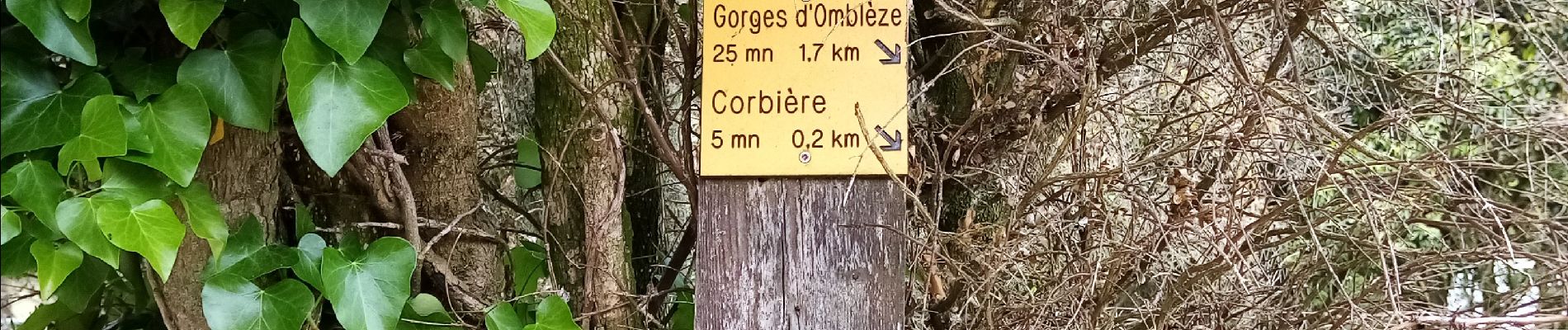
Canyon du Gueulards- Ombleze

crocau
User

Length
9.3 km

Max alt
824 m

Uphill gradient
356 m
Km-Effort
14 km

Min alt
566 m

Downhill gradient
356 m
Boucle
Yes
Creation date :
2020-05-23 09:37:35.555
Updated on :
2024-10-29 23:57:55.041
3h10
Difficulty : Difficult

FREE GPS app for hiking
 SityTrail
IGN / Geographical institutes
SityTrail Plus
The world is yours!
About
Trail Walking of 9.3 km to be discovered at Auvergne-Rhône-Alpes, Drôme, Plan-de-Baix. This trail is proposed by crocau.
Photos


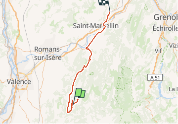
Positioning
Country:
France
Region :
Auvergne-Rhône-Alpes
Department/Province :
Drôme
Municipality :
Plan-de-Baix
Location:
Unknown
Start:(Dec)
Start:(UTM)
672843 ; 4967186 (31T) N.
Comments