


Le bois Chatelard

Sigmut
User
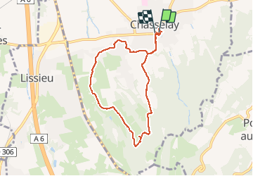

Length
7.8 km

Max alt
401 m

Uphill gradient
199 m
Km-Effort
10.5 km

Min alt
235 m

Downhill gradient
203 m
Boucle
Yes
Creation date :
2020-05-21 10:14:28.849
Updated on :
2020-07-30 21:39:59.752
3h48
Difficulty : Easy

FREE GPS app for hiking
 SityTrail
IGN / Geographical institutes
SityTrail Plus
The world is yours!
About
Trail Walking of 7.8 km to be discovered at Auvergne-Rhône-Alpes, Rhône, Chasselay. This trail is proposed by Sigmut.
Description
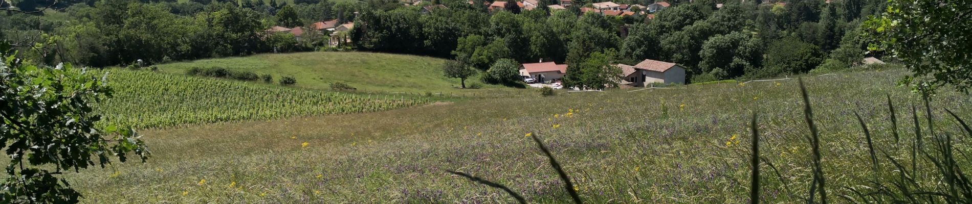
Paysages variés. Belle vue... Pour enfants de 3 et 5 ans.
Photos


22 photos in total. Please click on a photo to see them all in the gallery.
Positioning
Country:
France
Region :
Auvergne-Rhône-Alpes
Department/Province :
Rhône
Municipality :
Chasselay
Location:
Unknown
Start:(Dec)
Start:(UTM)
637537 ; 5081481 (31T) N.
Comments