


Montclergeon LA

michel.pegaz
User
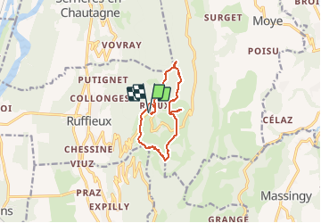

Length
10.1 km

Max alt
1025 m

Uphill gradient
328 m
Km-Effort
14.4 km

Min alt
808 m

Downhill gradient
328 m
Boucle
Yes
Creation date :
2020-05-21 07:36:32.0
Updated on :
2021-04-13 16:51:55.586
3h10
Difficulty : Unknown

FREE GPS app for hiking
 SityTrail
IGN / Geographical institutes
SityTrail Plus
The world is yours!
About
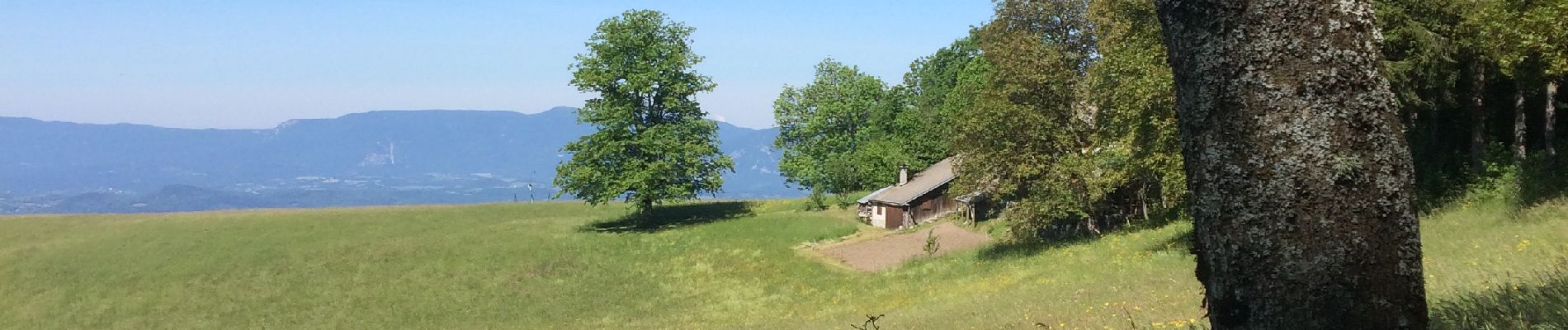
Trail Walking of 10.1 km to be discovered at Auvergne-Rhône-Alpes, Savoy, Ruffieux. This trail is proposed by michel.pegaz.
Photos


Positioning
Country:
France
Region :
Auvergne-Rhône-Alpes
Department/Province :
Savoy
Municipality :
Ruffieux
Location:
Unknown
Start:(Dec)
Start:(UTM)
722583 ; 5081561 (31T) N.
Comments