


Bellignat Merpuis vallée de l Ain Bellignat

cailloux54
User
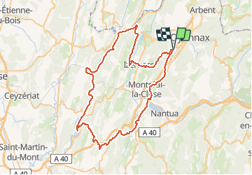

Length
73 km

Max alt
693 m

Uphill gradient
1265 m
Km-Effort
90 km

Min alt
270 m

Downhill gradient
1265 m
Boucle
Yes
Creation date :
2020-05-27 11:18:14.493
Updated on :
2020-05-27 20:37:48.25
4h16
Difficulty : Easy

FREE GPS app for hiking
 SityTrail
IGN / Geographical institutes
SityTrail Plus
The world is yours!
About
Trail Electric bike of 73 km to be discovered at Auvergne-Rhône-Alpes, Ain, Bellignat. This trail is proposed by cailloux54.
Positioning
Country:
France
Region :
Auvergne-Rhône-Alpes
Department/Province :
Ain
Municipality :
Bellignat
Location:
Unknown
Start:(Dec)
Start:(UTM)
702300 ; 5124107 (31T) N.
Comments