


Tour de l'Esterel par routes et belles pistes

rene06530
User

Length
44 km

Max alt
469 m

Uphill gradient
972 m
Km-Effort
57 km

Min alt
14 m

Downhill gradient
1022 m
Boucle
No
Creation date :
2020-05-28 07:06:36.244
Updated on :
2020-05-29 13:34:44.592
3h21
Difficulty : Difficult

FREE GPS app for hiking
 SityTrail
IGN / Geographical institutes
SityTrail Plus
The world is yours!
About
Trail Mountain bike of 44 km to be discovered at Provence-Alpes-Côte d'Azur, Var, Fréjus. This trail is proposed by rene06530.
Description
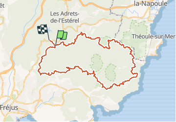
Départ du Malpey, Route d'Italie jusqu'au pont de la Bècasse, piste Castelli, parking de Belle Barbe, gué du grenouillet jusque col de l'évéque, Col Notre Dame, Route des crêtes jusque Malpey.
Positioning
Country:
France
Region :
Provence-Alpes-Côte d'Azur
Department/Province :
Var
Municipality :
Fréjus
Location:
Unknown
Start:(Dec)
Start:(UTM)
322278 ; 4818216 (32T) N.
Comments