


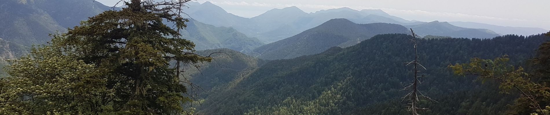
PIC CALMETE

Daniel Benteux
User
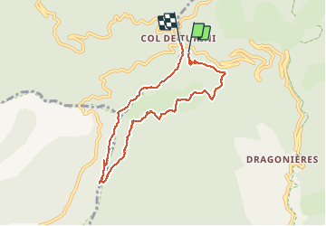

Length
8.2 km

Max alt
1783 m

Uphill gradient
364 m
Km-Effort
13.1 km

Min alt
1533 m

Downhill gradient
380 m
Boucle
Yes
Creation date :
2020-05-28 07:23:20.613
Updated on :
2020-05-28 12:45:34.547
2h56
Difficulty : Medium

FREE GPS app for hiking
 SityTrail
IGN / Geographical institutes
SityTrail Plus
The world is yours!
About
Trail Walking of 8.2 km to be discovered at Provence-Alpes-Côte d'Azur, Maritime Alps, Moulinet. This trail is proposed by Daniel Benteux.
Description
marche
Photos

Positioning
Country:
France
Region :
Provence-Alpes-Côte d'Azur
Department/Province :
Maritime Alps
Municipality :
Moulinet
Location:
Unknown
Start:(Dec)
Start:(UTM)
371141 ; 4870438 (32T) N.
Comments