Trail Walking Rosis - Le sommet du Plo des Brus dans l'Espinouse - Photo

Le sommet du Plo des Brus dans l'Espinouse

© OpenStreetMap contributors
Length
Length
11.5 km
Max alt
Max alt
1100 m
Uphill gradient
Uphill gradient
549 m
Km-Effort
Km-Effort  
18.8 km
Min alt
Min alt
676 m
Downhill gradient
Downhill gradient
547 m
Boucle
Boucle
Yes
Creation date :
2020-05-28 07:49:20.0
Updated on :
2020-06-12 08:23:06.974

(0 Reviews)

Walking
Walking
5h07
Difficulty : Difficult

Scan this QR Code to open this trail in the SityTrail application

FREE GPS app for hiking

Logo SityTrail SityTrail

IGN / Geographical institutes

Download SityTrail from the App Store Download SityTrail from Google Play

Logo SityTrail SityTrail Plus

The world is yours!

Download SityTrail from the App Store Download SityTrail from Google Play Download SityTrail on Huawei AppGallery

About

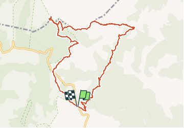
Trail Walking of 11.5 km to be discovered at Occitania, Hérault, Rosis. This trail is proposed by PiloudeBamako.

Description

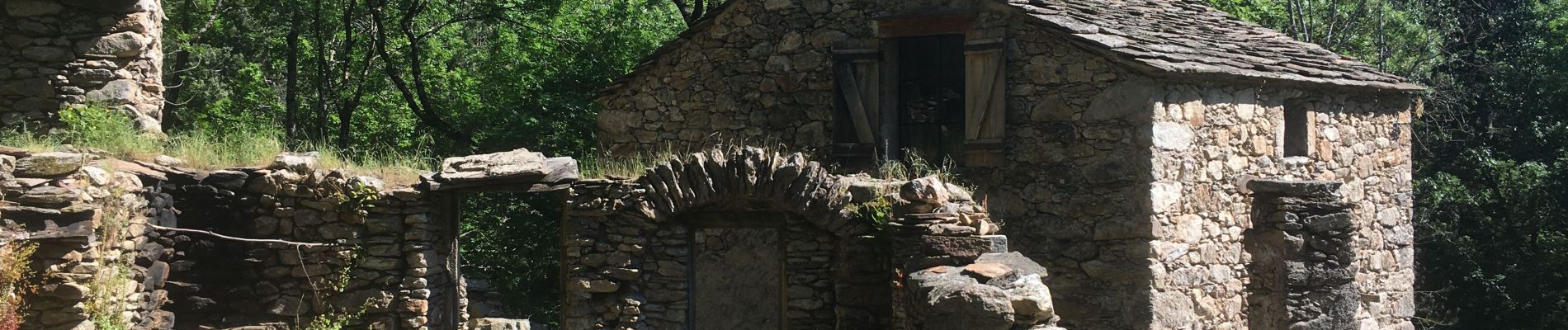
Départ du "Rond-Point" (sur la D180 - commune de Rosis) - Col de la Plane - Hameaux abandonnés de Caissenols - Serre de Majous (vue sur le Portail de Roquandouïre) - Plo des Brus (1 098m) - Col de l'Ourtigas.

Elevation profile

Photos

26 photos in total. Please click on a photo to see them all in the gallery.

Positioning

Country:
France
Region :
Occitania
Department/Province :
Hérault
Municipality :
Rosis
Location:
Unknown
Start:(Dec)
Start:(UTM)
498217 ; 4830935 (31T) N.


Close
My subscriptions