


Curtillet-2020-05-22

Valmeinier
User

Length
17.1 km

Max alt
1910 m

Uphill gradient
1154 m
Km-Effort
32 km

Min alt
838 m

Downhill gradient
1158 m
Boucle
Yes
Creation date :
2020-05-30 12:33:47.034
Updated on :
2020-05-30 12:43:08.947
--
Difficulty : Unknown

FREE GPS app for hiking
 SityTrail
IGN / Geographical institutes
SityTrail Plus
The world is yours!
About
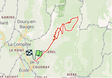
Trail Walking of 17.1 km to be discovered at Auvergne-Rhône-Alpes, Savoy, Jarsy. This trail is proposed by Valmeinier.
Positioning
Country:
France
Region :
Auvergne-Rhône-Alpes
Department/Province :
Savoy
Municipality :
Jarsy
Location:
Unknown
Start:(Dec)
Start:(UTM)
280163 ; 5059907 (32T) N.
Comments