


Clairmarai

yves62410
User
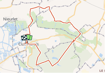

Length
19.6 km

Max alt
44 m

Uphill gradient
140 m
Km-Effort
21 km

Min alt
-1 m

Downhill gradient
134 m
Boucle
No
Creation date :
2020-05-31 09:08:16.0
Updated on :
2020-05-31 15:33:38.148
5h08
Difficulty : Difficult

FREE GPS app for hiking
 SityTrail
IGN / Geographical institutes
SityTrail Plus
The world is yours!
About
Trail Walking of 19.6 km to be discovered at Hauts-de-France, Pas-de-Calais, Clairmarais. This trail is proposed by yves62410.
Description
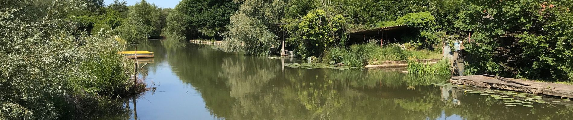
Première partie le long des canaux
Deuxième partie dans les bois(à faire par temps sec)
Photos


Positioning
Country:
France
Region :
Hauts-de-France
Department/Province :
Pas-de-Calais
Municipality :
Clairmarais
Location:
Unknown
Start:(Dec)
Start:(UTM)
450635 ; 5624476 (31U) N.
Comments
Les étoiles surtout pour la première partie