


la chapelle St Médard par SAOU / 8 Km

okfred26
User
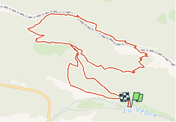

Length
8 km

Max alt
846 m

Uphill gradient
476 m
Km-Effort
14.3 km

Min alt
402 m

Downhill gradient
476 m
Boucle
Yes
Creation date :
2020-06-01 05:42:52.329
Updated on :
2020-06-06 19:00:08.28
3h00
Difficulty : Medium

FREE GPS app for hiking
 SityTrail
IGN / Geographical institutes
SityTrail Plus
The world is yours!
About
Trail Walking of 8 km to be discovered at Auvergne-Rhône-Alpes, Drôme, Saou. This trail is proposed by okfred26.
Positioning
Country:
France
Region :
Auvergne-Rhône-Alpes
Department/Province :
Drôme
Municipality :
Saou
Location:
Unknown
Start:(Dec)
Start:(UTM)
667296 ; 4946990 (31T) N.
Comments