


Vergers cerisier poiriers

fxhedon
User
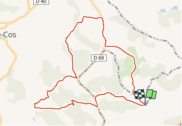

Length
11.4 km

Max alt
201 m

Uphill gradient
275 m
Km-Effort
15.1 km

Min alt
104 m

Downhill gradient
278 m
Boucle
Yes
Creation date :
2020-05-31 13:56:16.0
Updated on :
2020-06-05 07:33:59.397
2h41
Difficulty : Unknown

FREE GPS app for hiking
 SityTrail
IGN / Geographical institutes
SityTrail Plus
The world is yours!
About
Trail Walking of 11.4 km to be discovered at Occitania, Tarn-et-Garonne, Lamothe-Capdeville. This trail is proposed by fxhedon.
Positioning
Country:
France
Region :
Occitania
Department/Province :
Tarn-et-Garonne
Municipality :
Lamothe-Capdeville
Location:
Unknown
Start:(Dec)
Start:(UTM)
372080 ; 4884701 (31T) N.
Comments