Trail Walking Landunvez - Kersaint -St Samson - Photo

Kersaint -St Samson

 HERRY
HERRY

User GUIDE

© OpenStreetMap contributors
Length
Length
8 km
Max alt
Max alt
33 m
Uphill gradient
Uphill gradient
85 m
Km-Effort
Km-Effort  
9.2 km
Min alt
Min alt
-1 m
Downhill gradient
Downhill gradient
86 m
Boucle
Boucle
Yes
Creation date :
2020-06-06 12:58:40.0
Updated on :
2020-06-06 20:39:46.889

(0 Reviews)

Walking
Walking
2h04
Difficulty : Unknown

Scan this QR Code to open this trail in the SityTrail application

FREE GPS app for hiking

Logo SityTrail SityTrail

IGN / Geographical institutes

Download SityTrail from the App Store Download SityTrail from Google Play

Logo SityTrail SityTrail World

The world is yours!

Download SityTrail from the App Store Download SityTrail from Google Play Download SityTrail on Huawei AppGallery

About

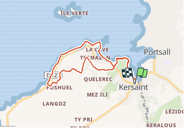
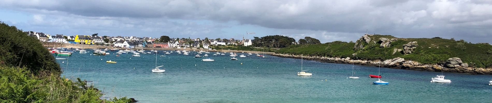
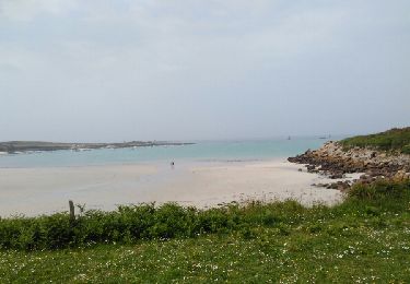
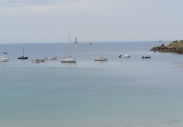
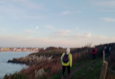
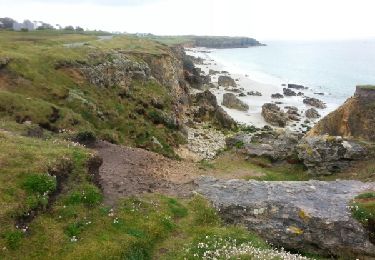
Trail Walking of 8 km to be discovered at Brittany, Finistère, Landunvez. This trail is proposed by HERRY.

Description

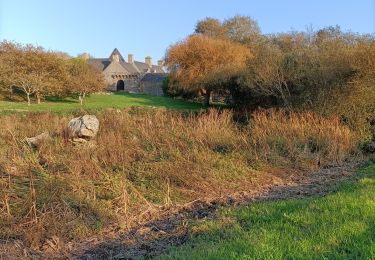
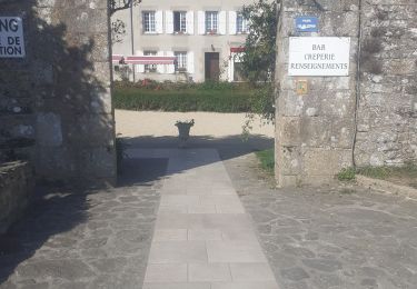
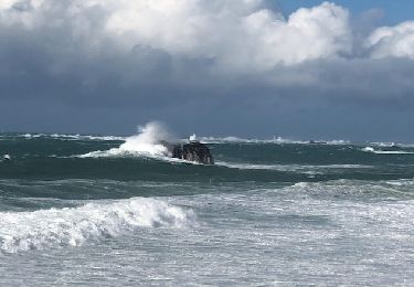
Garez la voiture sur le parking de La Chapelle de Kersaint suivre le GR qui se trouve en contrebas du parking et qui longe la côte jusqu'à la plage de Trémazan. En fonction de la marée vous pouvez passer par la plage ou si la mer est haute vous devrez suivre la route qui mène au début de la route touristique. Au niveau du parking de la route touristique  reprendre le GR côtier qui vous mènera à La Chapelle de St-Samson. A La Chapelle traversez la route et suivez un sentier à travers champs qui vous amène au hameau de gwel Kaer . continuez un moment sur la route puis avant le château d'eau bifurquez sur la gauche. Au passage allez voir la gravure sur le château.Vous rejoindrez trémazan puis à nouveau le GR qui amènera au castel et à la plage de Trémazan . Là vous récupérez  la première partie du parcours joignant la plage de Trémazan à La Chapelle de Kersaint.

Elevation profile

Photos

Positioning

Country:
France
Region :
Brittany
Department/Province :
Finistère
Municipality :
Landunvez
Location:
Unknown
Start:(UTM)
374125 ; 5378785 (30U) N.

Trails nearby

Trail Other activity Ploudalmézeau - portsall - Photo
Other activity
fiorepatrick

Other activity

Very easy
(1)
Ploudalmézeau, Brittany, Finistère, France
11.9 km | 13.6 km-effort
2h 37min
Yes
Trail Walking Ploudalmézeau - 08.09.23  Ploudalmézeau  --  Lanildut  - Photo
Walking
donda

Walking

Very difficult
Ploudalmézeau, Brittany, Finistère, France
22 km | 25 km-effort
5h 38min
No
Trail sport Ploudalmézeau - Portsall - Photo
sport
lebregien

sport

Very easy
(1)
Ploudalmézeau, Brittany, Finistère, France
11.3 km | 12.4 km-effort
Unknown
Yes
Trail Nordic walking Ploudalmézeau - portsall - Photo
Nordic walking
elianette

Nordic walking

Very easy
Ploudalmézeau, Brittany, Finistère, France
8.9 km | 10.4 km-effort
18min
No
Trail Nordic walking Porspoder - porspoder - Photo
Nordic walking
elianette

Nordic walking

Very easy
Porspoder, Brittany, Finistère, France
13.2 km | 14.4 km-effort
3h 13min
Yes
Trail Walking Ploudalmézeau - portsall trouzilit - Photo
Walking
RoMo

Walking

Medium
Ploudalmézeau, Brittany, Finistère, France
22 km | 25 km-effort
6h 2min
No
Trail Walking Landunvez - Tremazan  - Photo
Walking
GUIDE
HERRY

Walking

Very easy
Landunvez, Brittany, Finistère, France
6.2 km | 6.9 km-effort
2h 0min
Yes
Trail Walking Porspoder - GR 34 étape 32 - Photo
Walking
lagardienne

Walking

Easy
Porspoder, Brittany, Finistère, France
33 km | 37 km-effort
8h 44min
No
Trail Cycle Porspoder - Les Menhirs, circuit n°3 - Photo
Cycle
tracegps

Cycle

Medium
Porspoder, Brittany, Finistère, France
25 km | 29 km-effort
1h 30min
Yes


Close
My subscriptions