


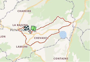
Picherande le lac Chauvet

jeanic63
User

Length
16.9 km

Max alt
1204 m

Uphill gradient
382 m
Km-Effort
22 km

Min alt
1036 m

Downhill gradient
376 m
Boucle
Yes
Creation date :
2020-06-07 14:53:45.3
Updated on :
2020-07-09 16:37:22.42
--
Difficulty : Medium

FREE GPS app for hiking
 SityTrail
IGN / Geographical institutes
SityTrail Plus
The world is yours!
About
Trail On foot of 16.9 km to be discovered at Auvergne-Rhône-Alpes, Puy-de-Dôme, Picherande. This trail is proposed by jeanic63.
Description
départ prés de Picherande lieu-dit Ravel
Positioning
Country:
France
Region :
Auvergne-Rhône-Alpes
Department/Province :
Puy-de-Dôme
Municipality :
Picherande
Location:
Unknown
Start:(Dec)
Start:(UTM)
483232 ; 5034146 (31T) N.
Comments