


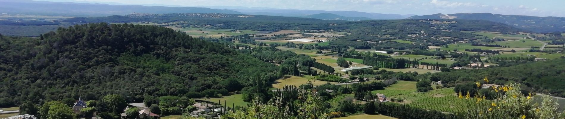
Clansayes Côte du Serre Chapelle Toronne 7km

thonyc
User GUIDE
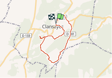

Length
7.3 km

Max alt
290 m

Uphill gradient
219 m
Km-Effort
10.3 km

Min alt
144 m

Downhill gradient
222 m
Boucle
Yes
Creation date :
2020-06-07 12:33:56.42
Updated on :
2020-06-07 22:22:53.069
2h32
Difficulty : Very easy

FREE GPS app for hiking
 SityTrail
IGN / Geographical institutes
SityTrail Plus
The world is yours!
About
Trail Walking of 7.3 km to be discovered at Auvergne-Rhône-Alpes, Drôme, Clansayes. This trail is proposed by thonyc.
Photos


Positioning
Country:
France
Region :
Auvergne-Rhône-Alpes
Department/Province :
Drôme
Municipality :
Clansayes
Location:
Unknown
Start:(Dec)
Start:(UTM)
644091 ; 4914775 (31T) N.
Comments