


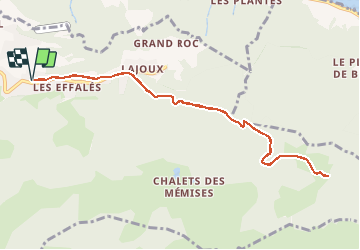

9.2 km | 22 km-effort


User


FREE GPS app for hiking
 SityTrail
IGN / Geographical institutes
SityTrail World
The world is yours!
Trail On foot of 10.1 km to be discovered at Auvergne-Rhône-Alpes, Upper Savoy, Thollon-les-Mémises. This trail is proposed by otbernex.
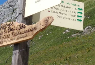
Depuis Thollon Tourisme, suivez les indications pour Lajoux en longeant la route goudronnée. Prenez le chemin à gauche avant le restaurant l’Outa puis vous passez devant une grotte et suivez, en face, le chemin de Croix. Au panneau Lajoux, prenez le chemin forestier sur la droite en direction du Col de Cornien. Passez le col pour arriver aux chalets. Retour par le même chemin.

Walking
Walking
Walking
Walking
Nordic walking

Walking

Walking
Walking
Walking