


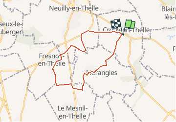
Crouy-en-thelle-12km

Djaie60
User

Length
12.4 km

Max alt
119 m

Uphill gradient
110 m
Km-Effort
13.9 km

Min alt
62 m

Downhill gradient
109 m
Boucle
Yes
Creation date :
2020-06-11 08:17:04.0
Updated on :
2020-06-29 12:46:45.051
--
Difficulty : Very easy

FREE GPS app for hiking
 SityTrail
IGN / Geographical institutes
SityTrail Plus
The world is yours!
About
Trail On foot of 12.4 km to be discovered at Hauts-de-France, Oise, Crouy-en-Thelle. This trail is proposed by Djaie60.
Positioning
Country:
France
Region :
Hauts-de-France
Department/Province :
Oise
Municipality :
Crouy-en-Thelle
Location:
Unknown
Start:(Dec)
Start:(UTM)
450494 ; 5451271 (31U) N.
Comments