


Fenols

CANON2
User
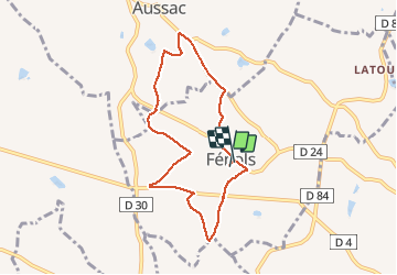

Length
7.6 km

Max alt
224 m

Uphill gradient
105 m
Km-Effort
9 km

Min alt
178 m

Downhill gradient
109 m
Boucle
Yes
Creation date :
2020-06-14 08:23:28.0
Updated on :
2020-06-14 10:54:37.771
2h29
Difficulty : Unknown

FREE GPS app for hiking
 SityTrail
IGN / Geographical institutes
SityTrail Plus
The world is yours!
About
Trail Walking of 7.6 km to be discovered at Occitania, Tarn, Fénols. This trail is proposed by CANON2.
Positioning
Country:
France
Region :
Occitania
Department/Province :
Tarn
Municipality :
Fénols
Location:
Unknown
Start:(Dec)
Start:(UTM)
423790 ; 4855270 (31T) N.
Comments