


Saillans Chplle St Christophe 14km

thonyc
User GUIDE


Length
14.1 km

Max alt
656 m

Uphill gradient
437 m
Km-Effort
19.9 km

Min alt
262 m

Downhill gradient
446 m
Boucle
Yes
Creation date :
2020-06-14 09:00:15.611
Updated on :
2021-02-17 09:41:30.32
4h42
Difficulty : Medium

FREE GPS app for hiking
 SityTrail
IGN / Geographical institutes
SityTrail Plus
The world is yours!
About
Trail Walking of 14.1 km to be discovered at Auvergne-Rhône-Alpes, Drôme, Saillans. This trail is proposed by thonyc.
Description
Chapelle St Christophe
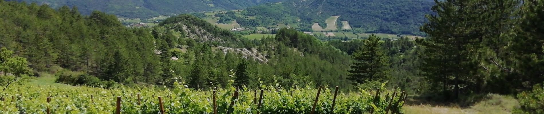
Panoramas sur la vallée de la Drôme et sur les 3 Becs
Photos


Positioning
Country:
France
Region :
Auvergne-Rhône-Alpes
Department/Province :
Drôme
Municipality :
Saillans
Location:
Unknown
Start:(Dec)
Start:(UTM)
674309 ; 4951687 (31T) N.
Comments