


SEMNOZ boucle depuis visitation

Jean-Paulchoux
User
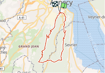

Length
17.4 km

Max alt
985 m

Uphill gradient
667 m
Km-Effort
26 km

Min alt
509 m

Downhill gradient
672 m
Boucle
Yes
Creation date :
2020-06-14 07:04:52.732
Updated on :
2020-06-14 15:31:04.523
6h43
Difficulty : Medium

FREE GPS app for hiking
 SityTrail
IGN / Geographical institutes
SityTrail Plus
The world is yours!
About
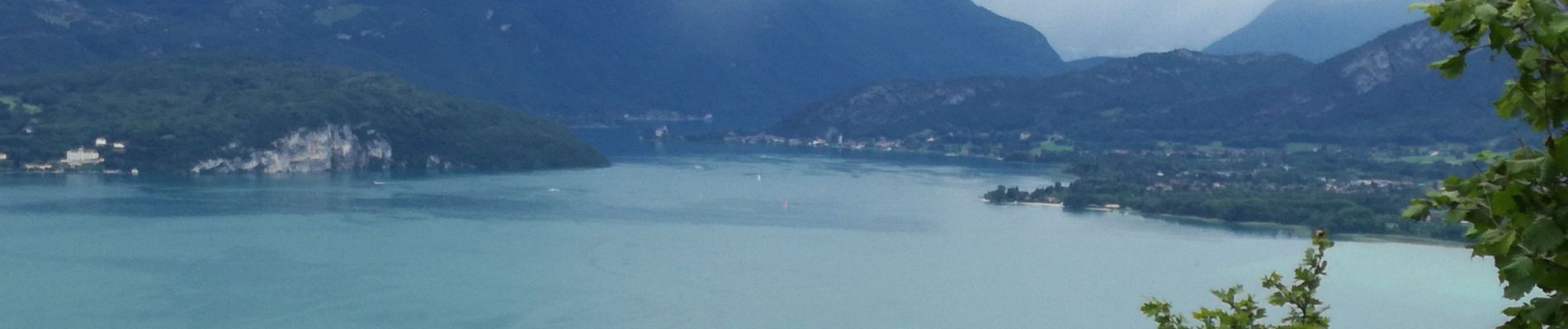
Trail Walking of 17.4 km to be discovered at Auvergne-Rhône-Alpes, Upper Savoy, Annecy. This trail is proposed by Jean-Paulchoux.
Photos


Positioning
Country:
France
Region :
Auvergne-Rhône-Alpes
Department/Province :
Upper Savoy
Municipality :
Annecy
Location:
Annecy
Start:(Dec)
Start:(UTM)
277139 ; 5085956 (32T) N.
Comments