


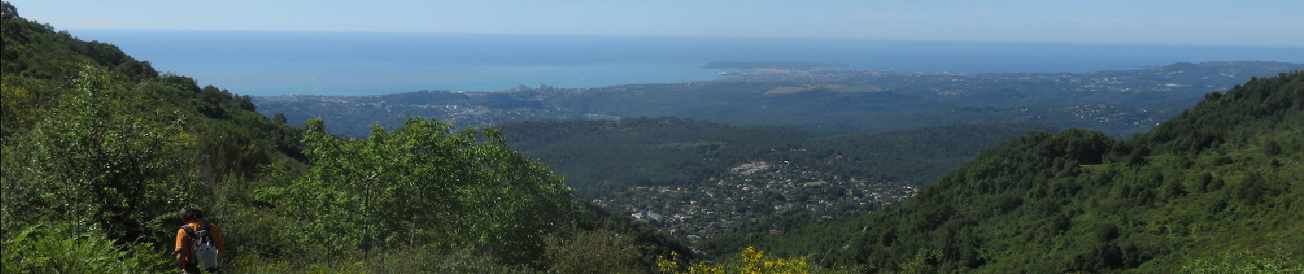
Puy de Tourrettes et plateau de Saint Barnabé

aris
User


8h03
Difficulty : Medium

FREE GPS app for hiking
 SityTrail
IGN / Geographical institutes
SityTrail Plus
The world is yours!
About
Trail Walking of 20 km to be discovered at Provence-Alpes-Côte d'Azur, Maritime Alps, Vence. This trail is proposed by aris.
Description
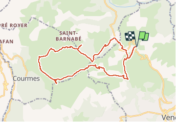
Départ du parking sous le col de Vence. A partir de la borne 177, cheminement hors-sentier, vers le sommet évident (bonne montée sous le Soleil). Vue extraordinaire en haut du puy de Tourrettes, du Mercantour à la Corse. Retour par les pistes larges du plateau de Saint Barnabé. Portion hors sentier à partir de la borne 261 pour rejoindre le col de Vence, dans un terrain facile, herbe et cailloux (cheminement au GPS et en suivant le cap).
Photos


Positioning
Comments