


Tarsimoure

raygautier
User
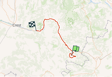

Length
72 km

Max alt
1533 m

Uphill gradient
1246 m
Km-Effort
90 km

Min alt
264 m

Downhill gradient
1852 m
Boucle
No
Creation date :
2020-06-14 07:19:28.0
Updated on :
2020-06-14 17:44:57.648
5h06
Difficulty : Unknown

FREE GPS app for hiking
 SityTrail
IGN / Geographical institutes
SityTrail Plus
The world is yours!
About
Trail Walking of 72 km to be discovered at Auvergne-Rhône-Alpes, Drôme, Charens. This trail is proposed by raygautier.
Positioning
Country:
France
Region :
Auvergne-Rhône-Alpes
Department/Province :
Drôme
Municipality :
Charens
Location:
Unknown
Start:(Dec)
Start:(UTM)
699359 ; 4934335 (31T) N.
Comments