


mayres château montlaur

raab
User

Length
7.5 km

Max alt
833 m

Uphill gradient
294 m
Km-Effort
11.5 km

Min alt
575 m

Downhill gradient
297 m
Boucle
Yes
Creation date :
2020-06-16 07:00:10.069
Updated on :
2020-06-17 08:40:42.051
2h36
Difficulty : Medium

FREE GPS app for hiking
 SityTrail
IGN / Geographical institutes
SityTrail Plus
The world is yours!
About
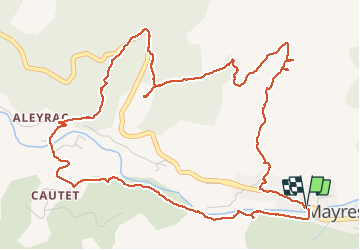
Trail Walking of 7.5 km to be discovered at Auvergne-Rhône-Alpes, Ardèche, Mayres. This trail is proposed by raab.
Positioning
Country:
France
Region :
Auvergne-Rhône-Alpes
Department/Province :
Ardèche
Municipality :
Mayres
Location:
Unknown
Start:(Dec)
Start:(UTM)
588116 ; 4946462 (31T) N.
Comments