D'une rive à l'autre de la Fontaulière

raab
User
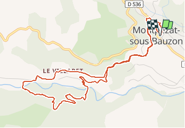

Length
6.8 km

Max alt
644 m

Uphill gradient
229 m
Km-Effort
9.8 km

Min alt
535 m

Downhill gradient
224 m
Boucle
Yes
Creation date :
2020-06-17 08:35:34.375
Updated on :
2020-06-17 08:36:52.586

FREE GPS app for hiking
 SityTrail
IGN / Geographical institutes
SityTrail Plus
The world is yours!
About
Trail of 6.8 km to be discovered at Auvergne-Rhône-Alpes, Ardèche, Montpezat-sous-Bauzon. This trail is proposed by raab.


Positioning
Country:
France
Region :
Auvergne-Rhône-Alpes
Department/Province :
Ardèche
Municipality :
Montpezat-sous-Bauzon
Location:
Unknown
Start:(Dec)
Start:(UTM)
595679 ; 4951547 (31T) N.
Comments