


THORENC 2

Daniel Benteux
User

Length
10.3 km

Max alt
1373 m

Uphill gradient
403 m
Km-Effort
15.5 km

Min alt
1123 m

Downhill gradient
350 m
Boucle
No
Creation date :
2020-06-18 07:16:48.427
Updated on :
2020-06-18 15:18:09.287
3h01
Difficulty : Easy

FREE GPS app for hiking
 SityTrail
IGN / Geographical institutes
SityTrail Plus
The world is yours!
About
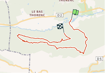
Trail Walking of 10.3 km to be discovered at Provence-Alpes-Côte d'Azur, Maritime Alps, Andon. This trail is proposed by Daniel Benteux.
Photos

Positioning
Country:
France
Region :
Provence-Alpes-Côte d'Azur
Department/Province :
Maritime Alps
Municipality :
Andon
Location:
Unknown
Start:(Dec)
Start:(UTM)
323661 ; 4851643 (32T) N.
Comments