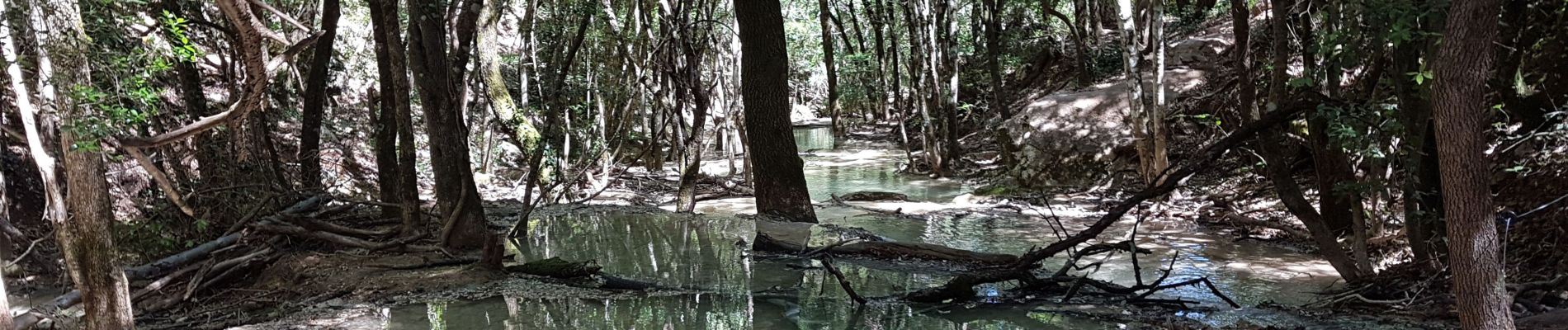
Sainte Baume : Nans les Pins - Chemin des Roys _ Les source de L'Huveaune

phidge
User
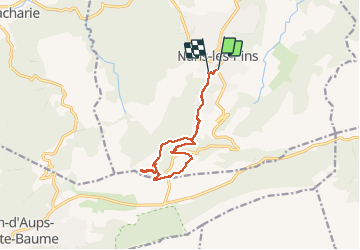

Length
11.6 km

Max alt
707 m

Uphill gradient
481 m
Km-Effort
18 km

Min alt
394 m

Downhill gradient
459 m
Boucle
No
Creation date :
2020-06-20 05:55:33.303
Updated on :
2020-07-11 14:22:23.232
4h33
Difficulty : Very easy

FREE GPS app for hiking
 SityTrail
IGN / Geographical institutes
SityTrail Plus
The world is yours!
About
Trail Walking of 11.6 km to be discovered at Provence-Alpes-Côte d'Azur, Var, Nans-les-Pins. This trail is proposed by phidge.
Photos


Positioning
Country:
France
Region :
Provence-Alpes-Côte d'Azur
Department/Province :
Var
Municipality :
Nans-les-Pins
Location:
Unknown
Start:(Dec)
Start:(UTM)
725571 ; 4805618 (31T) N.
Comments