


Route vers les Steven étang

yves62410
User

Length
79 km

Max alt
114 m

Uphill gradient
644 m
Km-Effort
87 km

Min alt
0 m

Downhill gradient
671 m
Boucle
No
Creation date :
2020-06-21 09:27:28.0
Updated on :
2020-06-21 10:30:19.485
1h02
Difficulty : Unknown

FREE GPS app for hiking
 SityTrail
IGN / Geographical institutes
SityTrail Plus
The world is yours!
About
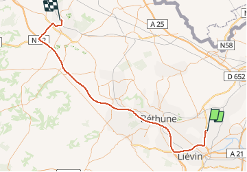
Trail Car of 79 km to be discovered at Hauts-de-France, Pas-de-Calais, Wingles. This trail is proposed by yves62410.
Description
Dires
Positioning
Country:
France
Region :
Hauts-de-France
Department/Province :
Pas-de-Calais
Municipality :
Wingles
Location:
Unknown
Start:(Dec)
Start:(UTM)
488744 ; 5593091 (31U) N.
Comments