


Jaunac 10km

thonyc
User GUIDE
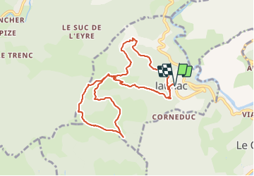

Length
9.3 km

Max alt
906 m

Uphill gradient
354 m
Km-Effort
14 km

Min alt
587 m

Downhill gradient
354 m
Boucle
Yes
Creation date :
2020-06-21 08:35:03.954
Updated on :
2021-06-11 05:49:42.692
4h38
Difficulty : Easy

FREE GPS app for hiking
 SityTrail
IGN / Geographical institutes
SityTrail Plus
The world is yours!
About
Trail Walking of 9.3 km to be discovered at Auvergne-Rhône-Alpes, Ardèche, Jaunac. This trail is proposed by thonyc.
Description
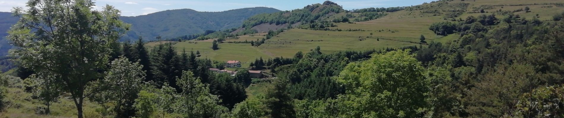
Panoramas magnifiques: Gerbier de Joncs, Mt Mézenc, Suc de Sarra, vallée de l'Eyrieux
Photos


Positioning
Country:
France
Region :
Auvergne-Rhône-Alpes
Department/Province :
Ardèche
Municipality :
Jaunac
Location:
Unknown
Start:(Dec)
Start:(UTM)
610534 ; 4974963 (31T) N.
Comments