


LE SAPEY boucle la Rosiere l'ovine n°2

Jean-Paulchoux
User
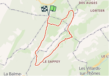

Length
17.2 km

Max alt
1800 m

Uphill gradient
801 m
Km-Effort
28 km

Min alt
1181 m

Downhill gradient
801 m
Boucle
Yes
Creation date :
2020-06-21 07:38:35.059
Updated on :
2020-06-21 20:07:10.632
5h28
Difficulty : Medium

FREE GPS app for hiking
 SityTrail
IGN / Geographical institutes
SityTrail Plus
The world is yours!
About
Trail Walking of 17.2 km to be discovered at Auvergne-Rhône-Alpes, Upper Savoy, Fillière. This trail is proposed by Jean-Paulchoux.
Positioning
Country:
France
Region :
Auvergne-Rhône-Alpes
Department/Province :
Upper Savoy
Municipality :
Fillière
Location:
Thorens-Glières
Start:(Dec)
Start:(UTM)
291874 ; 5091823 (32T) N.
Comments