


lac des ramiers

Monjean
User

Length
7.9 km

Max alt
614 m

Uphill gradient
170 m
Km-Effort
10.1 km

Min alt
466 m

Downhill gradient
165 m
Boucle
Yes
Creation date :
2020-06-21 12:35:14.923
Updated on :
2020-06-21 23:05:36.833
2h33
Difficulty : Very easy

FREE GPS app for hiking
 SityTrail
IGN / Geographical institutes
SityTrail Plus
The world is yours!
About
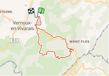
Trail Walking of 7.9 km to be discovered at Auvergne-Rhône-Alpes, Ardèche, Vernoux-en-Vivarais. This trail is proposed by Monjean.
Positioning
Country:
France
Region :
Auvergne-Rhône-Alpes
Department/Province :
Ardèche
Municipality :
Vernoux-en-Vivarais
Location:
Unknown
Start:(Dec)
Start:(UTM)
630577 ; 4973125 (31T) N.
Comments
bien, pas très longue, mais trop de route