


Tracé_22-JUIN-20 142647

rigol05
User
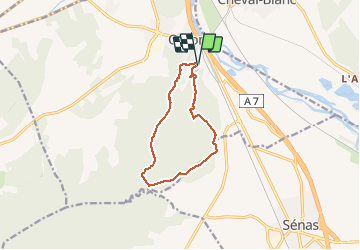

Length
10.7 km

Max alt
273 m

Uphill gradient
219 m
Km-Effort
13.6 km

Min alt
88 m

Downhill gradient
214 m
Boucle
Yes
Creation date :
2020-06-22 15:47:24.271
Updated on :
2020-06-29 13:03:41.434
--
Difficulty : Easy

FREE GPS app for hiking
 SityTrail
IGN / Geographical institutes
SityTrail Plus
The world is yours!
About
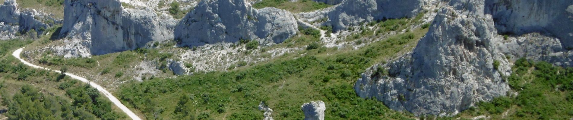
Trail On foot of 10.7 km to be discovered at Provence-Alpes-Côte d'Azur, Bouches-du-Rhône, Orgon. This trail is proposed by rigol05.
Description
Randonnée classique de la région effectuée le 22 juin 2020
Photos


Positioning
Country:
France
Region :
Provence-Alpes-Côte d'Azur
Department/Province :
Bouches-du-Rhône
Municipality :
Orgon
Location:
Unknown
Start:(Dec)
Start:(UTM)
664420 ; 4849938 (31T) N.
Comments