


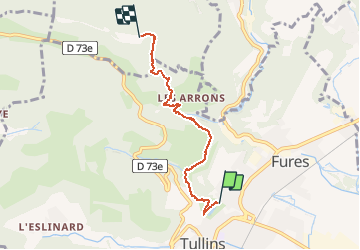
mairie tullins - monastère de Parmenie

trailer38
User

Length
4.6 km

Max alt
731 m

Uphill gradient
473 m
Km-Effort
9.3 km

Min alt
254 m

Downhill gradient
0 m
Boucle
No
Creation date :
2020-06-23 17:32:56.936
Updated on :
2020-06-23 18:19:27.145
45m
Difficulty : Very easy

FREE GPS app for hiking
 SityTrail
IGN / Geographical institutes
SityTrail Plus
The world is yours!
About
Trail Running of 4.6 km to be discovered at Auvergne-Rhône-Alpes, Isère, Tullins. This trail is proposed by trailer38.
Description
au plus rapide par les chemins
50 min en courant
Positioning
Country:
France
Region :
Auvergne-Rhône-Alpes
Department/Province :
Isère
Municipality :
Tullins
Location:
Unknown
Start:(Dec)
Start:(UTM)
694880 ; 5019573 (31T) N.
Comments