


SAT_20180813

guy284
User
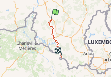

Length
95 km

Max alt
463 m

Uphill gradient
2009 m
Km-Effort
121 km

Min alt
188 m

Downhill gradient
1981 m
Boucle
No
Creation date :
2020-06-23 19:32:44.478
Updated on :
2020-06-23 22:11:19.993
--
Difficulty : Unknown

FREE GPS app for hiking
 SityTrail
IGN / Geographical institutes
SityTrail Plus
The world is yours!
About
Trail Walking of 95 km to be discovered at Wallonia, Luxembourg, Wellin. This trail is proposed by guy284.
Description
SAT 2022
Positioning
Country:
Belgium
Region :
Wallonia
Department/Province :
Luxembourg
Municipality :
Wellin
Location:
Chanly
Start:(Dec)
Start:(UTM)
654006 ; 5549686 (31U) N.
Comments