


Ceyssat le tour du puy de Dome

jeanic63
User
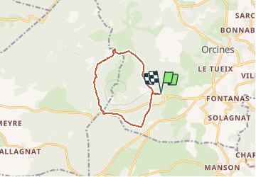

Length
9.4 km

Max alt
1126 m

Uphill gradient
266 m
Km-Effort
13 km

Min alt
909 m

Downhill gradient
265 m
Boucle
Yes
Creation date :
2020-06-24 19:18:15.459
Updated on :
2020-06-25 16:01:22.703
--
Difficulty : Medium

FREE GPS app for hiking
 SityTrail
IGN / Geographical institutes
SityTrail Plus
The world is yours!
About
Trail On foot of 9.4 km to be discovered at Auvergne-Rhône-Alpes, Puy-de-Dôme, Orcines. This trail is proposed by jeanic63.
Description
départ parking haut de la gare du train à crémaillière
Positioning
Country:
France
Region :
Auvergne-Rhône-Alpes
Department/Province :
Puy-de-Dôme
Municipality :
Orcines
Location:
Unknown
Start:(Dec)
Start:(UTM)
498762 ; 5068498 (31T) N.
Comments