


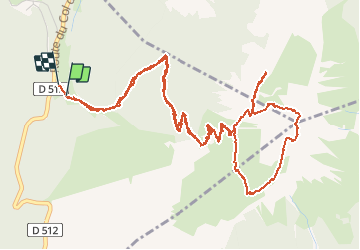
Chamechaude par le ravin en passant par le sangle du Jardin

trailer38
User

Length
7.9 km

Max alt
2040 m

Uphill gradient
750 m
Km-Effort
18 km

Min alt
1328 m

Downhill gradient
756 m
Boucle
Yes
Creation date :
2020-06-24 13:57:50.671
Updated on :
2020-06-24 20:27:55.138
3h18
Difficulty : Very easy

FREE GPS app for hiking
 SityTrail
IGN / Geographical institutes
SityTrail Plus
The world is yours!
About
Trail Walking of 7.9 km to be discovered at Auvergne-Rhône-Alpes, Isère, Sarcenas. This trail is proposed by trailer38.
Positioning
Country:
France
Region :
Auvergne-Rhône-Alpes
Department/Province :
Isère
Municipality :
Sarcenas
Location:
Unknown
Start:(Dec)
Start:(UTM)
717064 ; 5018775 (31T) N.
Comments