


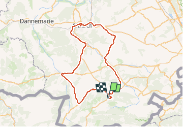
Altkirch

PhilippeC54
User

Length
64 km

Max alt
569 m

Uphill gradient
789 m
Km-Effort
74 km

Min alt
271 m

Downhill gradient
789 m
Boucle
Yes
Creation date :
2020-06-26 07:21:04.605
Updated on :
2020-06-26 11:09:51.034
3h26
Difficulty : Medium

FREE GPS app for hiking
 SityTrail
IGN / Geographical institutes
SityTrail Plus
The world is yours!
About
Trail Road bike of 64 km to be discovered at Grand Est, Haut-Rhin, Ferrette. This trail is proposed by PhilippeC54.
Description
circuits 5 et 4
Positioning
Country:
France
Region :
Grand Est
Department/Province :
Haut-Rhin
Municipality :
Ferrette
Location:
Unknown
Start:(Dec)
Start:(UTM)
372777 ; 5260868 (32T) N.
Comments