


creissels1_cascades

cmar
User
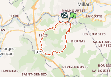

Length
11.2 km

Max alt
773 m

Uphill gradient
493 m
Km-Effort
17.8 km

Min alt
353 m

Downhill gradient
495 m
Boucle
Yes
Creation date :
2020-06-30 19:07:36.175
Updated on :
2020-06-30 19:08:02.934
--
Difficulty : Very easy

FREE GPS app for hiking
 SityTrail
IGN / Geographical institutes
SityTrail Plus
The world is yours!
About
Trail On foot of 11.2 km to be discovered at Occitania, Aveyron, Creissels. This trail is proposed by cmar.
Positioning
Country:
France
Region :
Occitania
Department/Province :
Aveyron
Municipality :
Creissels
Location:
Unknown
Start:(Dec)
Start:(UTM)
504855 ; 4881426 (31T) N.
Comments