


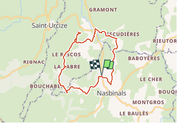
Camping de Nasbinals - Recoules en Aubrac

maupassant38
User

Length
15.9 km

Max alt
1203 m

Uphill gradient
291 m
Km-Effort
19.8 km

Min alt
1065 m

Downhill gradient
291 m
Boucle
Yes
Creation date :
2020-07-01 07:09:27.676
Updated on :
2020-07-01 10:42:11.349
3h18
Difficulty : Medium

FREE GPS app for hiking
 SityTrail
IGN / Geographical institutes
SityTrail Plus
The world is yours!
About
Trail Walking of 15.9 km to be discovered at Occitania, Lozère, Nasbinals. This trail is proposed by maupassant38.
Positioning
Country:
France
Region :
Occitania
Department/Province :
Lozère
Municipality :
Nasbinals
Location:
Unknown
Start:(Dec)
Start:(UTM)
503135 ; 4946430 (31T) N.
Comments