


télésiège de la sambuy

whisper73
User

Length
6.2 km

Max alt
1828 m

Uphill gradient
1064 m
Km-Effort
16.9 km

Min alt
764 m

Downhill gradient
20 m
Boucle
No
Creation date :
2020-07-04 05:22:14.695
Updated on :
2020-07-04 07:29:32.873
2h06
Difficulty : Difficult
1h00
Difficulty : Medium

FREE GPS app for hiking
 SityTrail
IGN / Geographical institutes
SityTrail Plus
The world is yours!
About
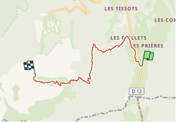
Trail Walking of 6.2 km to be discovered at Auvergne-Rhône-Alpes, Upper Savoy, Faverges-Seythenex. This trail is proposed by whisper73.
Positioning
Country:
France
Region :
Auvergne-Rhône-Alpes
Department/Province :
Upper Savoy
Municipality :
Faverges-Seythenex
Location:
Seythenex
Start:(Dec)
Start:(UTM)
290548 ; 5064314 (32T) N.
Comments