


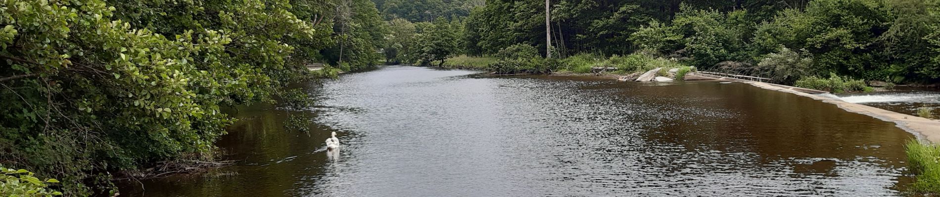
rando de la truite : stavelot . challes . warche . chevaufosse . challes . stavelot

stef789
User GUIDE
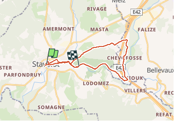

Length
14.3 km

Max alt
428 m

Uphill gradient
267 m
Km-Effort
17.8 km

Min alt
277 m

Downhill gradient
257 m
Boucle
No
Creation date :
2020-07-04 12:37:59.454
Updated on :
2020-07-04 17:58:01.143
3h40
Difficulty : Very easy

FREE GPS app for hiking
 SityTrail
IGN / Geographical institutes
SityTrail Plus
The world is yours!
About
Trail Walking of 14.3 km to be discovered at Wallonia, Liège, Stavelot. This trail is proposed by stef789.
Photos


Positioning
Country:
Belgium
Region :
Wallonia
Department/Province :
Liège
Municipality :
Stavelot
Location:
Stavelot
Start:(Dec)
Start:(UTM)
708349 ; 5586572 (31U) N.
Comments