


2020 07 KAKOYETTA

michel1025
User
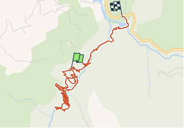

Length
6.7 km

Max alt
788 m

Uphill gradient
906 m
Km-Effort
19.4 km

Min alt
462 m

Downhill gradient
1108 m
Boucle
No
Creation date :
2020-07-05 14:02:40.0
Updated on :
2020-07-05 15:46:41.502
1h43
Difficulty : Unknown

FREE GPS app for hiking
 SityTrail
IGN / Geographical institutes
SityTrail Plus
The world is yours!
About
Trail Walking of 6.7 km to be discovered at New Aquitaine, Pyrénées-Atlantiques, Sainte-Engrâce. This trail is proposed by michel1025.
Positioning
Country:
France
Region :
New Aquitaine
Department/Province :
Pyrénées-Atlantiques
Municipality :
Sainte-Engrâce
Location:
Unknown
Start:(Dec)
Start:(UTM)
675344 ; 4762214 (30T) N.
Comments