


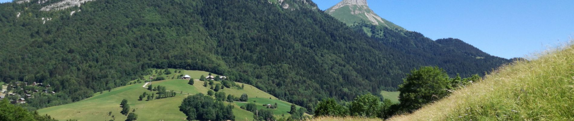
MONT PELAT boucle

Jean-Paulchoux
User
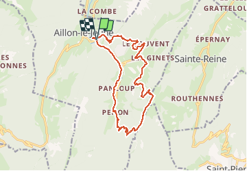

Length
16.8 km

Max alt
1535 m

Uphill gradient
947 m
Km-Effort
29 km

Min alt
912 m

Downhill gradient
945 m
Boucle
Yes
Creation date :
2020-07-05 06:52:15.599
Updated on :
2020-07-05 16:52:29.654
6h53
Difficulty : Medium

FREE GPS app for hiking
 SityTrail
IGN / Geographical institutes
SityTrail Plus
The world is yours!
About
Trail Walking of 16.8 km to be discovered at Auvergne-Rhône-Alpes, Savoy, Aillon-le-Jeune. This trail is proposed by Jean-Paulchoux.
Photos


Positioning
Country:
France
Region :
Auvergne-Rhône-Alpes
Department/Province :
Savoy
Municipality :
Aillon-le-Jeune
Location:
Unknown
Start:(Dec)
Start:(UTM)
272899 ; 5055562 (32T) N.
Comments