Trail Walking Tende - Roche de l'Abisse - Photo
 aris
aris

User

© OpenStreetMap contributors
Length
Length
13 km
Max alt
Max alt
2735 m
Uphill gradient
Uphill gradient
960 m
Km-Effort
Km-Effort  
26 km
Min alt
Min alt
1894 m
Downhill gradient
Downhill gradient
960 m
Boucle
Boucle
Yes
Creation date :
2020-07-05 06:36:36.683
Updated on :
2020-07-05 21:27:40.322

(0 Reviews)

Walking
Walking
7h32
Difficulty : Medium

Scan this QR Code to open this trail in the SityTrail application

FREE GPS app for hiking

Logo SityTrail SityTrail

IGN / Geographical institutes

Download SityTrail from the App Store Download SityTrail from Google Play

Logo SityTrail SityTrail Plus

The world is yours!

Download SityTrail from the App Store Download SityTrail from Google Play Download SityTrail on Huawei AppGallery

About

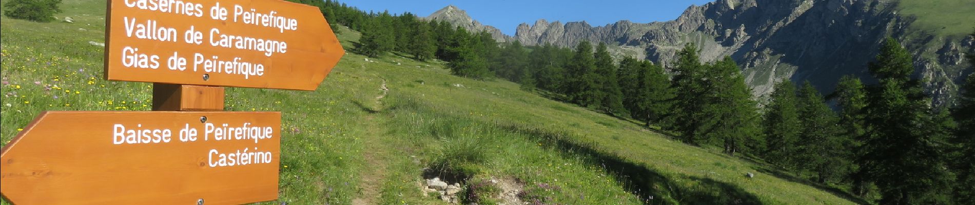
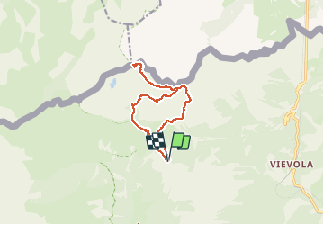
Trail Walking of 13 km to be discovered at Provence-Alpes-Côte d'Azur, Maritime Alps, Tende. This trail is proposed by aris.

Description

Bien beau sommet. Vue panoramique sur le Mercantour (Gélas, Argentera, Margareis...), la plaine du Po, le Mont Viso, et au loin les Alpes suisses (Breithorn, Cervin). Au retour, portion hors sentier entre le fort de Giaure et la piste au pont de Peyrefique, cheminement facile dans l'herbe.

Elevation profile

Photos

Positioning

Country:
France
Region :
Provence-Alpes-Côte d'Azur
Department/Province :
Maritime Alps
Municipality :
Tende
Location:
Unknown
Start:(UTM)
381416 ; 4885933 (32T) N.


Close
My subscriptions