


POINTE DE BANC PLAT - REPOSOIR

sandra_leb
User


4h41
Difficulty : Very difficult

FREE GPS app for hiking
 SityTrail
IGN / Geographical institutes
SityTrail Plus
The world is yours!
About
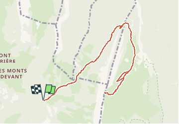
Trail Walking of 12.7 km to be discovered at Auvergne-Rhône-Alpes, Savoy, Bellecombe-en-Bauges. This trail is proposed by sandra_leb.
Description
L'ascension depuis le Reposoir, lieu-dit de Bellecombe-en-Bauges, passe par le Col de Bornette pour emprunter aux Ailes du Nant, un sentier absent d'IGN. Le passage économise une centaine de mètres de dénivelé pour atteindre le pittoresque chemin de la Combe, taillé dans le rocher de la falaise pour offrir aux troupeaux un accès à l'alpage. Par le chalet-refuge de la Combe, une piste récente parcourt la Montagne du Charbon pour retrouver le vieux sentier qui donne accès aux pentes herbeuses sous le sommet de la Pointe de Banc Plat. Le retour se fait par le même itinéraire.
Positioning
Comments