


chamroussillon

sylvainstaels
User

Length
26 km

Max alt
2124 m

Uphill gradient
1504 m
Km-Effort
46 km

Min alt
1000 m

Downhill gradient
1491 m
Boucle
Yes
Creation date :
2020-07-07 20:21:03.085
Updated on :
2020-07-07 20:21:34.822
2h51
Difficulty : Very difficult

FREE GPS app for hiking
 SityTrail
IGN / Geographical institutes
SityTrail Plus
The world is yours!
About
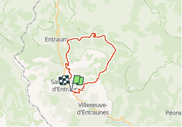
Trail Mountain bike of 26 km to be discovered at Provence-Alpes-Côte d'Azur, Maritime Alps, Saint-Martin-d'Entraunes. This trail is proposed by sylvainstaels.
Positioning
Country:
France
Region :
Provence-Alpes-Côte d'Azur
Department/Province :
Maritime Alps
Municipality :
Saint-Martin-d'Entraunes
Location:
Unknown
Start:(Dec)
Start:(UTM)
321385 ; 4889481 (32T) N.
Comments