


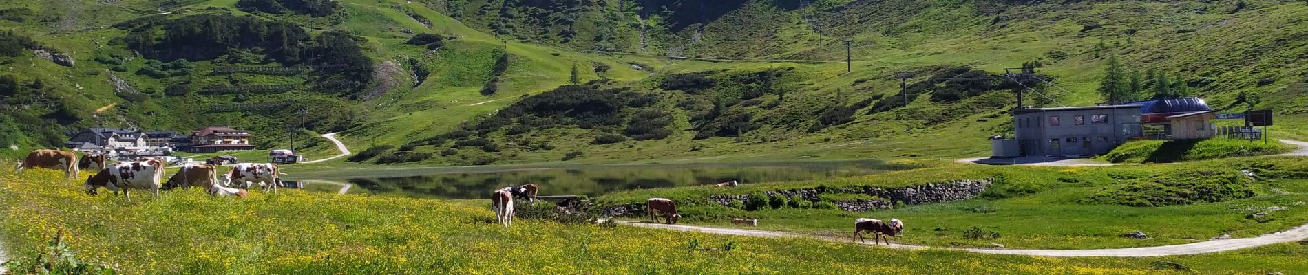
Seekarspitze

Arnaud Dejean
User
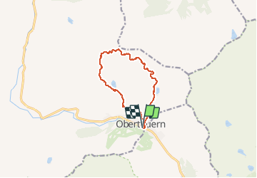

Length
10.6 km

Max alt
2316 m

Uphill gradient
612 m
Km-Effort
18.8 km

Min alt
1733 m

Downhill gradient
612 m
Boucle
Yes
Creation date :
2020-07-10 07:07:40.612
Updated on :
2020-07-11 16:50:02.429
4h27
Difficulty : Difficult

FREE GPS app for hiking
 SityTrail
IGN / Geographical institutes
SityTrail Plus
The world is yours!
About
Trail Walking of 10.6 km to be discovered at Salzburg, Bezirk St. Johann im Pongau, Untertauern. This trail is proposed by Arnaud Dejean.
Photos


51 photos in total. Please click on a photo to see them all in the gallery.
Positioning
Country:
Austria
Region :
Salzburg
Department/Province :
Bezirk St. Johann im Pongau
Municipality :
Untertauern
Location:
Unknown
Start:(Dec)
Start:(UTM)
390882 ; 5233781 (33T) N.
Comments