


Or let

petergole
User
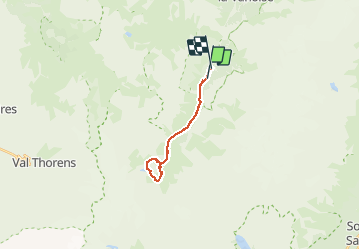

Length
17.2 km

Max alt
2496 m

Uphill gradient
782 m
Km-Effort
28 km

Min alt
1723 m

Downhill gradient
821 m
Boucle
No
Creation date :
2020-07-09 07:30:08.0
Updated on :
2020-07-10 12:28:54.637
7h51
Difficulty : Medium

FREE GPS app for hiking
 SityTrail
IGN / Geographical institutes
SityTrail Plus
The world is yours!
About
Trail Walking of 17.2 km to be discovered at Auvergne-Rhône-Alpes, Savoy, Pralognan-la-Vanoise. This trail is proposed by petergole.
Positioning
Country:
France
Region :
Auvergne-Rhône-Alpes
Department/Province :
Savoy
Municipality :
Pralognan-la-Vanoise
Location:
Unknown
Start:(Dec)
Start:(UTM)
319384 ; 5023114 (32T) N.
Comments