


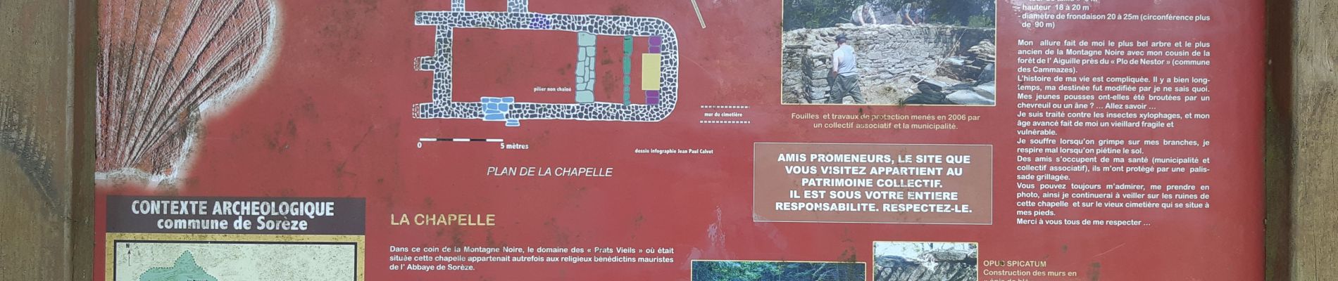
Arfons granges vieilles et croix de Montalric

tabouelle
User
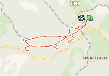

Length
9.2 km

Max alt
787 m

Uphill gradient
196 m
Km-Effort
11.8 km

Min alt
667 m

Downhill gradient
196 m
Boucle
Yes
Creation date :
2020-07-12 08:02:41.139
Updated on :
2020-07-12 12:56:51.078
3h26
Difficulty : Easy

FREE GPS app for hiking
 SityTrail
IGN / Geographical institutes
SityTrail Plus
The world is yours!
About
Trail Walking of 9.2 km to be discovered at Occitania, Tarn, Arfons. This trail is proposed by tabouelle.
Photos


Positioning
Country:
France
Region :
Occitania
Department/Province :
Tarn
Municipality :
Arfons
Location:
Unknown
Start:(Dec)
Start:(UTM)
430801 ; 4810681 (31T) N.
Comments