


2020-07-13_18h38m36_iti0134

jeanic63
User
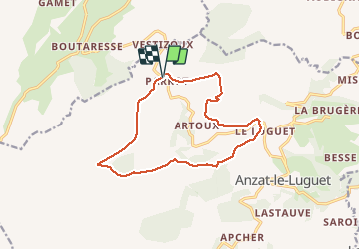

Length
13.7 km

Max alt
1546 m

Uphill gradient
479 m
Km-Effort
20 km

Min alt
1112 m

Downhill gradient
476 m
Boucle
Yes
Creation date :
2020-07-13 16:38:39.182
Updated on :
2020-07-26 16:45:40.591
--
Difficulty : Medium

FREE GPS app for hiking
 SityTrail
IGN / Geographical institutes
SityTrail Plus
The world is yours!
About
Trail On foot of 13.7 km to be discovered at Auvergne-Rhône-Alpes, Puy-de-Dôme, Anzat-le-Luguet. This trail is proposed by jeanic63.
Description
Départ parking de Parrot
Positioning
Country:
France
Region :
Auvergne-Rhône-Alpes
Department/Province :
Puy-de-Dôme
Municipality :
Anzat-le-Luguet
Location:
Unknown
Start:(Dec)
Start:(UTM)
499910 ; 5022437 (31T) N.
Comments