


lundi 27 07 20 traversée Chabournéou-Vallonpierre

jacquesduchesne
User

Length
16.6 km

Max alt
2290 m

Uphill gradient
878 m
Km-Effort
28 km

Min alt
1547 m

Downhill gradient
879 m
Boucle
Yes
Creation date :
2020-07-14 09:50:17.954
Updated on :
2020-07-14 11:03:15.908
5h46
Difficulty : Very difficult

FREE GPS app for hiking
 SityTrail
IGN / Geographical institutes
SityTrail Plus
The world is yours!
About
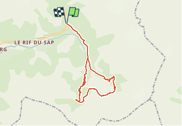
Trail Walking of 16.6 km to be discovered at Provence-Alpes-Côte d'Azur, Hautes-Alpes, La Chapelle-en-Valgaudémar. This trail is proposed by jacquesduchesne.
Photos


Positioning
Country:
France
Region :
Provence-Alpes-Côte d'Azur
Department/Province :
Hautes-Alpes
Municipality :
La Chapelle-en-Valgaudémar
Location:
Unknown
Start:(Dec)
Start:(UTM)
285262 ; 4968271 (32T) N.
Comments